

The innovators - 1981 Honda Accord - First-map-based navigation system

The cars we drive today were influenced by these pioneers First-map-based navigation system. By: Gareth Dean GarethD_CARmag
There’s many an adage wheeled out by travellers extolling the virtues of getting lost as an essential part of any adventure. However, when you’re late for an important business, or you’re feverishly scanning the horizon for any sign of a petrol station as the needle on your fuel gauge dips into the red, such sentiment takes a back seat to real-world issues. The calming, dulcet tones of an intelligent satellite navigation system are the only thing you want to hear. Electronic in-car navigation systems are fairly recent on the timeline of automotive tech.
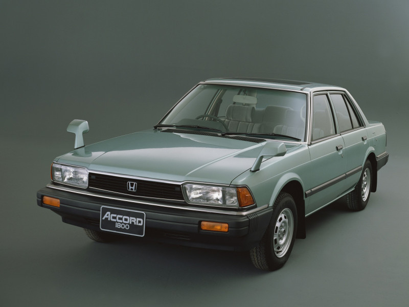
Indeed, many of us were wrestling with paper road maps the size of a double duvet not all that long ago. It was in 1981 that Honda teamed up with car audio giant Alpine to create the precursor to modern navigation.
Back in the early ’80s,most of the close-earth satellite network was dedicated to telecomms; GPS (global positioning satellite) technology – which utilises a network of close-orbit satellites to accurately triangulate position – was in its infancy and primarily directed towards heavy scientific and military applications. The age of publicly accessible GPS-enabled navigation was still some way off, so the folks at Honda and Alpine opted instead for a known positional tracking technology in the form of inertial navigation. This uses a combination of computers, accelerometers and dead reckoning – a means of navigation involving fixed positions and average speed used hundreds of years before Columbus discovered the Americas – to plot relative position on the move.
Honda’s system, dubbed the “Electro Gyrocator”, utilised an inertial module similar to those in guided missiles. This was overseen by a helium-gas gyroscope and a servo attached to the car’s transmission housing that fed such parameters as speed and distance to the Gyrocator.
This information was then transmitted to a six-inch monochrome CRT monitor mounted in the dashboard, over which a series of acetate map overlays could be placed. As the car was driven, a dot projected on the screen would move across the overlaid map in accordance with input from the inertial guidance system. There were also settings within the Gyrocator that plotted a line on the screen to show your path of travel and a set of Honda-approved pens were offered, enabling drivers to make their own annotations on the maps.
The system was accurate for its time but its electromechanical workings meant the areas it could cover were limited to the acetates on offer; namely the Tokyo metropolitan area. The unit was also bulky, weighing almost 10 kg, and constituted around a quarter of the price of the car to which it was fitted. The production run lasted just a year before less bulky CD ROM-based systems came to the fore in 1987, followed in 1990 by the first example of the GPS-enabled setup widely in use today.
THEY ALSO PAVED THE WAY
1987 TOYOTA CROWN
The ’87-model Crown was the first car to utilise a CD ROM-based navigation system. The unit used dead reckoning and was the first of its kind to feature a colour CRT screen.
1990 MAZDA EUNOS COSMO
Renowned for its tri-rotor Wankel engine, the Eunos was also the first production-series car to feature a built-in GPS navigation system.
1996 ACURA RL
The ’96 RL would usher in the use of hard disk drives as the storage medium of choice for its GPS-enabled navigation system, supplanting the slower-loading and more space constrained CD ROM.
2020 POLESTAR 2
Polestar’s fastback EV was one of the first cars to feature native Google services – including Google Maps – built into its infotainment system, thereby nixing the need for a smartphone connection.